Indian Creek Watershed
Watershed Planning in the
Fox River Watershed
The Chicago Metropolitan Agency for Planning (CMAP) received a Clean Water Act grant from the Illinois Environmental Protection Agency (EPA) in November 2019 to develop a watershed-based plan for the Indian Creek watershed in the Lower Fox River Basin. Additionally, the Fox River Study Group (FRSG) provided additional funding to support the update and application of an existing hydrologic and water quality model developed by the Illinois State Water Survey for the FRSG.
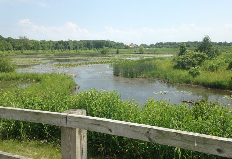
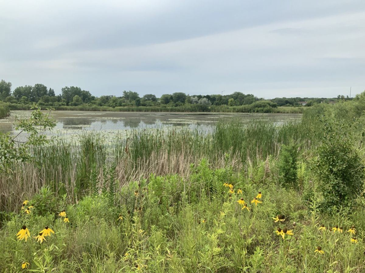
Above: View of the constructed wetland complex to the southeast of Bilter Road and Farnsworth Avenue in Aurora. The Chicago Premium Outlet mall is visible in the distance.
Photo courtesy of Mark Phipps, City of Aurora.
Photo courtesy of Mark Phipps, City of Aurora.
Indian Creek Watershed-based Planning
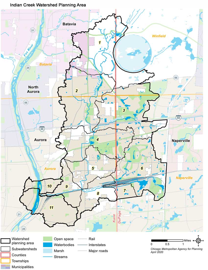
Straddling southeastern Kane and southwestern DuPage Counties, the Indian Creek watershed itself covers 14.4 square miles and includes portions of two municipalities (Aurora and Batavia) and four townships (Aurora, Batavia, Naperville, and Winfield). Indian Creek flows approximately 8.9 miles from its headwaters east of Batavia to its confluence with the Fox River just north of downtown Aurora. Two primary tributaries are the 2.5 mile long Selmarten Creek and the 4.0 mile long East Tributary. An additional 1.7 square mile area abutting the Indian Creek watershed and directly draining to the Fox River is included in the plan’s study area to form the 16.1 square mile Indian Creek Watershed Planning Area (see planning area map below).
The purpose of this plan is to work with local stakeholders to develop planning, policy, outreach and education, and on-the-ground project recommendations that upon implementation will help improve and protect the water quality in Indian Creek, its tributaries, the numerous wetlands, lakes and ponds within the watershed, as well as the Fox River. The plan must follow U.S. EPA and Illinois EPA guidelines, including meeting the “9 minimum elements” of a watershed-based plan.
The purpose of this plan is to work with local stakeholders to develop planning, policy, outreach and education, and on-the-ground project recommendations that upon implementation will help improve and protect the water quality in Indian Creek, its tributaries, the numerous wetlands, lakes and ponds within the watershed, as well as the Fox River. The plan must follow U.S. EPA and Illinois EPA guidelines, including meeting the “9 minimum elements” of a watershed-based plan.
Projects that are aimed at improving water quality – and that are identified in an Illinois EPA-approved watershed-based plan – are eligible for federal Clean Water Act program grant funding. Prospects for funding assistance also can be improved for other state and local grant and technical assistance programs.
Partners serving on the Advisory Team or Steering Committee represent the variety of stakeholders with an interest in the watershed – including county and local governments, districts, environmental organizations, businesses, and community groups – and will provide guidance and feedback throughout the planning process. The public will have opportunities to learn about and provide input during the watershed plan development process as well. A watershed resource inventory is scheduled for completion in October 2020. The full watershed-based plan is scheduled for completion in October 2021,with project wrap-up activities continuing through December 2021. Project and plan development news, updates, and documents will be provided on this webpage as well as announced through FREP’s monthly Downstream e-newsletter.
Resources & Documents
Map of Indian Creek Watershed pdf
Indian Creek Watershed-based Plan (Final draft, August 2023)
Indian Creek Watershed-based Plan – Executive Summary (Final draft, August 2023)
Indian Creek Watershed-based Plan (Final draft, August 2023)
Indian Creek Watershed-based Plan – Executive Summary (Final draft, August 2023)
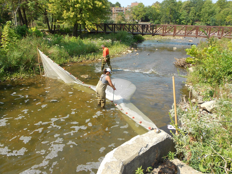
Above: Fish sampling near the mouth of Indian Creek by Deuchler staff, August 2012. Photo courtesy of Leonard Dane, Deuchler Engineering Corporation.
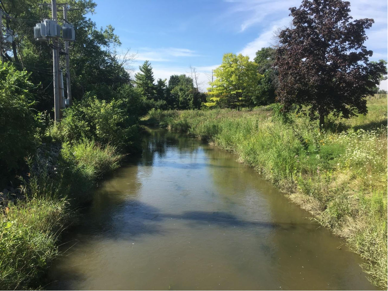
Above: Indian Creek as it flows southward, downstream from Reckinger Road in Aurora. Photo courtesy of Mark Phipps, City of Aurora.
Contact
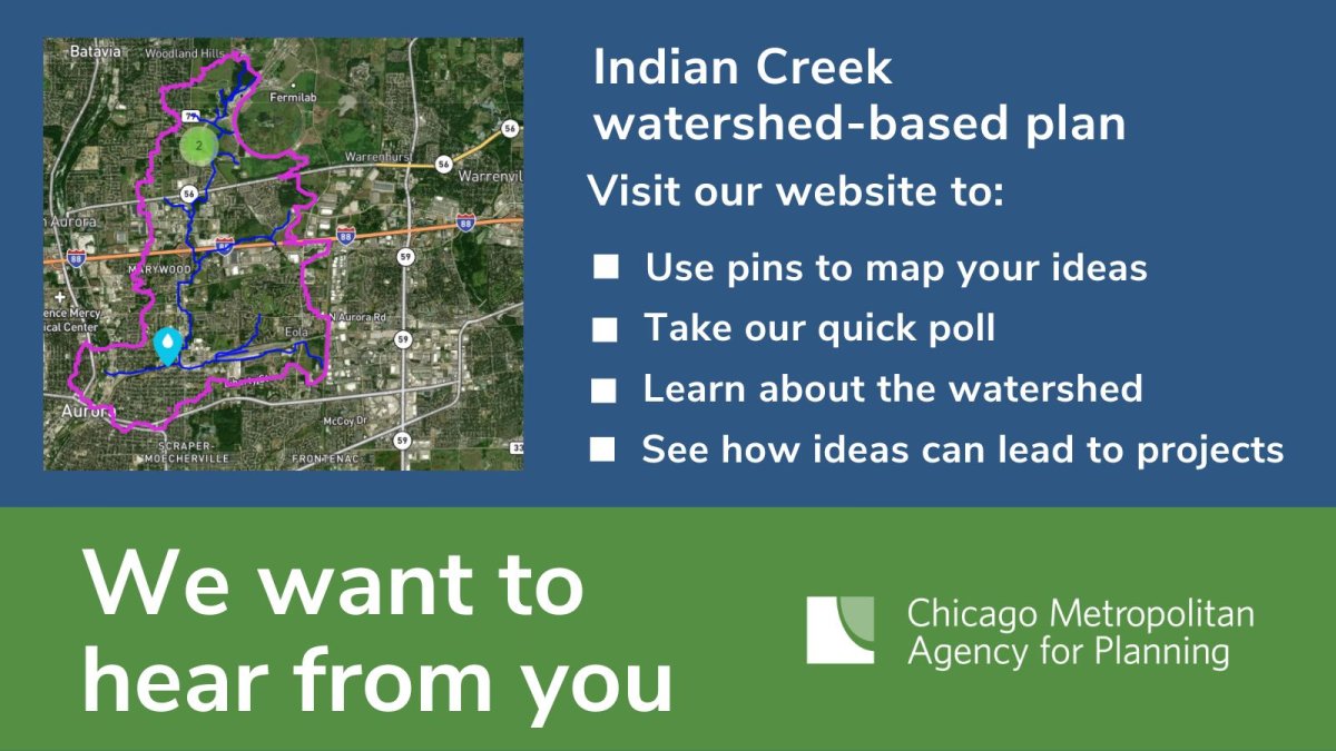
Learn more about the project and share ideas on the Indian Creek website. Input will help shape project recommendations, establish monitoring programs, update plans and policies, and create outreach and educational activities aimed at improving and protecting the quality of the Indian Creek watershed planning area.
PLANNING PROCESS/PROGRESS NOTES:
Indian Creek - August 29, 2023 Update
A final draft of the Indian Creek
Watershed-based Plan and an executive summary were submitted to Illinois EPA in
mid-August and are available for public review and comment. The documents are posted
above under the “Resources and Documents” section as well as on CMAP’s project
engagement webpage (https://engage.cmap.illinois.gov/indian-creek-watershed-based-plan)
under the “Project Documents” section. Comments can be submitted through the
CMAP engagement website in the “Plan Review Forum” section or directly via
email to Holly Hudson at CMAP (hhudson@cmap.illinois.gov).
Comments are due by October 17, 2023.
The plan includes more than 100 site-specific best management practices (BMPs) identified by stakeholders, as well as a suite of watershed-wide BMP scenarios which account for common BMP types that could potentially be implemented throughout the Indian Creek watershed planning area but are not associated with a site-specific location at this time. BMP opportunities include a variety of urban, agricultural, and hydrologic practices such as permeable pavements, detention basin retrofits, infiltration trenches, rain gardens, vegetated swales, grassed waterways, streamside vegetated buffers, streambank stabilization, and wetland restoration. Additional watershed protection-related opportunities noted include education and outreach activities and products, local plan and ordinance updates, coordinated resource management planning, and water quality monitoring programs.
Many thanks are extended to all who participated in the planning process! Comments received from Illinois EPA and local stakeholders will be addressed, a complete front and back cover will be prepared, and a finalized plan and executive summary will be posted to both the FREP and CMAP websites. However, the process of putting all those great ideas identified in the plan into action can start away!
If you have any questions about the project, comments on the final draft plan, or would like to discuss plan implementation ideas and opportunities, please contact Holly Hudson at CMAP: hhudson@cmap.illinois.gov or 312-386-8700.
Curious
about what you can do to help protect water quality and improve habitat
around your own residence, property, or business? Think about native
landscaping and rain gardens! The Conservation Foundation and the Greater Kane County Chapter of Wild Ones
are two of the groups that can help get you started!
are two of the groups that can help get you started!
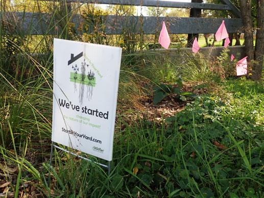
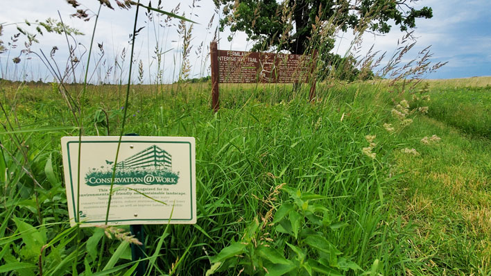
Photos by Holly Hudson. Above, sign at Tyler Creek Valley Subdivision in Elgin. Below, sign at Fermilab in Batavia.
Indian Creek - December 2, 2022 Update
CMAP staff are
wrapping up the dataset of best management practice (BMP) ideas
submitted through the public engagement website and via stakeholder
meetings and conversations. BMPs include urban and agricultural
“on-the-ground” projects, local plans and policy updates, public
education and outreach activities, and water quality monitoring
recommendations. The on-the-ground/construction-type BMPs will be
modeled by the project’s consultant, Geosyntec, to estimate how much
phosphorus, nitrogen, solids, bacteria, and chloride can be reduced
going to Indian Creek and the Fox River. This “pollutant load reduction”
estimate, along with planning level implementation cost estimates for
all the BMPs identified in the Indian Creek planning area, are among
U.S. EPA’s “nine minimum elements”
required in a watershed-based plan. The final plan will also include a
framework for implementing the plan’s recommendations over the next ten
years by outlining a general implementation schedule, criteria for
determining progress, and monitoring recommendations to evaluate
effectiveness, as well as by providing a list of grant funding and
technical assistance providers. An interim final draft of the Indian
Creek Watershed-based Plan was submitted to Illinois EPA on November 30,
with the final version slated for submittal by year’s end.
To see the BMP ideas submitted by stakeholders through the public engagement website, visit https://engage.cmap.illinois.gov/indian-creek-watershed-based-plan. If you have any questions about the project or would like to provide any input, please contact Holly Hudson at CMAP: hhudson@cmap.illinois.gov or 312-386-8700.
To see the BMP ideas submitted by stakeholders through the public engagement website, visit https://engage.cmap.illinois.gov/indian-creek-watershed-based-plan. If you have any questions about the project or would like to provide any input, please contact Holly Hudson at CMAP: hhudson@cmap.illinois.gov or 312-386-8700.
Indian Creek - November 2, 2022 Update
CMAP
staff are finalizing the dataset of best management practice (BMP)
ideas submitted through the public engagement website and via
stakeholder meetings and conversations. BMPs include urban and
agricultural “on-the-ground” projects, local plans and policy updates,
public education and outreach activities, and water quality monitoring
recommendations. The on-the-ground/construction-type BMPs will be
modeled by the project’s consultant, Geosyntec, to estimate how much
phosphorus, nitrogen, solids, bacteria, and chloride can be reduced
going to Indian Creek and the Fox River.
This “pollutant load reduction” estimate, along with planning level implementation cost estimates for all the BMPs identified in the Indian Creek planning area, are among U.S. EPA’s “nine minimum elements” required in a watershed-based plan. The planning process will then wrap up with a framework for implementing the plan’s recommendations over the next ten years, including a general implementation schedule, criteria for determining progress, and monitoring to evaluate effectiveness.
The final draft of the Indian Creek Watershed-based Plan is due to Illinois EPA at the end of November, with the final version slated by year’s end.
Indian Creek - October 3, 2022 Update
Many
thanks are extended to everyone who submitted watershed and water
quality concerns, comments, and ideas for improvements through the
public engagement website. CMAP staff are amid compiling all the input
received into a single dataset. The “on-the-ground”/construction-type
best management practice (BMP) project ideas will be modeled by the
project’s consultant, Geosyntec, to estimate how much phosphorus,
nitrogen, solids, bacteria, and chloride can be expected to be
reduced going to Indian Creek and the Fox River downstream. This
“pollutant load reduction” estimate, along
with
planning level implementation cost estimates for all the best practices
recommended in the Indian Creek planning area, are among U.S. EPA’s
“nine minimum elements” required in a watershed-based plan.
The planning process will then wrap up with a framework for implementing the plan’s recommendations over the next ten years, including a general implementation schedule, criteria for determining progress, and monitoring to evaluate effectiveness.
The planning process will then wrap up with a framework for implementing the plan’s recommendations over the next ten years, including a general implementation schedule, criteria for determining progress, and monitoring to evaluate effectiveness.
The final Indian Creek Watershed-based Plan is due to Illinois EPA at the end of November.
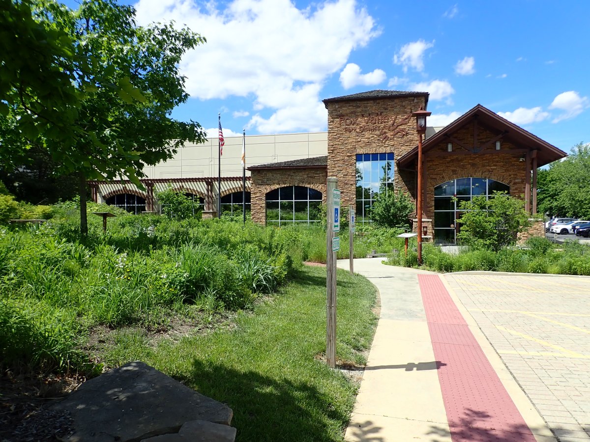
Left: The
permeable paver parking lot, rain gardens, and prairie vegetation at
the Fox Valley Park District offices in Aurora are examples of
stormwater best management practices that help protect the water quality
of the adjacent Fox River.
For project updates, documents, maps, and announcements, please explore the posts on this Indian Creek Watershed webpage.
If you have any questions about the project or would like to provide any input, please contact Holly Hudson at CMAP: hhudson@cmap.illinois.gov or 312-386-8700.
For project updates, documents, maps, and announcements, please explore the posts on this Indian Creek Watershed webpage.
If you have any questions about the project or would like to provide any input, please contact Holly Hudson at CMAP: hhudson@cmap.illinois.gov or 312-386-8700.
Indian Creek - August 30, 2022 Update
LAST CALL:
Public engagement webpage submittal period extended to September 20!
If you have not had a chance to visit https://engage.cmap.illinois.gov/indian-creek-watershed-basedplan yet, or have thought of additional input to enter, please take the time to do so now. Here you can share your insights and ideas for protecting and improving water and habitat quality in the Indian Creek watershed and adjacent Fox River via interactive maps, a quick poll, a short survey, and a comments forum.
If you have not had a chance to visit https://engage.cmap.illinois.gov/indian-creek-watershed-basedplan yet, or have thought of additional input to enter, please take the time to do so now. Here you can share your insights and ideas for protecting and improving water and habitat quality in the Indian Creek watershed and adjacent Fox River via interactive maps, a quick poll, a short survey, and a comments forum.
Input is welcome
from anyone with an interest – a stake – in the quality of the Indian
Creek watershed and adjacent Fox River. You do not have to live, work,
go to school, or have a business there to be a stakeholder! Perhaps you
visit the area to ride your bike on the Fox River Trail or Prairie Path,
hike the trails in Fermilab, or paddle on the Fox River. Maybe you’ve
shopped at the outlet mall or unique local shops, dined at one of the
many restaurants, enjoyed a festival, or went to hear some live music…
then you are a stakeholder too!
Please get your submittals in by September 20!
Please get your submittals in by September 20!
Indian Creek - June 30, 2022 Update
The public engagement webpage is waiting for you! Please see the information and graphic above and visit https://engage.cmap.illinois.gov/indian-creek-watershed-based-plan. Take a look around… here you can share your
insights and ideas for protecting and improving water and habitat quality in
the Indian Creek watershed and adjacent Fox River via maps, a quick poll, a
short survey, and a comments forum.
Through one interactive map, you can point out areas of concern (such as
flooding, erosion, water quality concerns), and through another interactive
map, you can add ideas for water quality-related projects, outreach and
education activities, monitoring programs, and policy and planning
updates.
Please get submittals in by July 22!
Your ideas for future actions are a big key piece of watershed-based plans like this one. This is where the lure hits the water, where the bricks hit the ground, where the money gets things going, where the… you get the picture! The water quality-related projects and programs identified in the Indian Creek Watershed-based Plan – collectively termed best management practices (BMPs) – will become eligible for applicable federal grants, including Clean Water Act “Section 319” Nonpoint Source Pollution Control Program grants. Inclusion also helps improve ranking for other state and local grants and technical assistance, such as Illinois EPA’s Green Infrastructure Grant Opportunities (GIGO) program and the Illinois Clean Energy Community Foundation’s Natural Areas Grant Program.
In other project news, a draft of the Indian Creek
Watershed-based Plan was submitted to Illinois EPA on June 30. The document is available to view and
download from the project webpage on the FREP website as well as on CMAP’s
project engagement webpage (see links below).
CMAP welcomes your comments and questions. Sections remaining to be rounded out include
the stream physical conditions and detention basin assessment portions of the
watershed resource inventory chapter, and of course the BMP recommendations that
are currently being gathered through the public engagement site.
Indian Creek - May 31, 2022 Update
Exciting news! The public engagement webpage will be live any day now. We want to hear from you! Please visit https://engage.cmap.illinois.gov/ and scroll to the Indian Creek Watershed-based Plan project. Here you
can share your insights and ideas for protecting and improving water and
habitat quality in the Indian Creek watershed and adjacent Fox River
via maps, a quick poll, a short survey, and a comments forum. Through
one interactive map, you can point out areas of concern (such as
flooding, erosion, water quality concerns), and through a second
interactive map, you can add ideas for water quality-related projects,
outreach and education activities, monitoring programs, and policy and
planning updates.
Input is welcome from anyone with an interest – a stake – in the quality of the Indian Creek watershed and adjacent Fox River. You don’t have to live, work, or have a business there to be a stakeholder! Perhaps you visit the area to ride your bike on the Fox River Trail or Prairie Path, hike the trails in Fermilab, or paddle on the Fox River. Maybe you’ve shopped at the outlet mall or unique local shops, dined at one of the many restaurants, enjoyed a festival, or went to hear some live music… then you are a stakeholder too!
The input received will help shape water quality-related recommendations that will be incorporated into the Indian Creek Watershed-based Plan. Of the many benefits of developing a watershed-based plan, a key one is that projects and programs identified in such plans become eligible for certain federal grants, including Clean Water Act “Section 319” Nonpoint Source Pollution Control Program grants, and it helps improve ranking for other state and local grants and technical assistance, such as Illinois EPA’s Green Infrastructure Grant Opportunities (GIGO) program.
To provide input and ideas to help inform plan recommendations, visit https://engage.cmap.illinois.gov/.
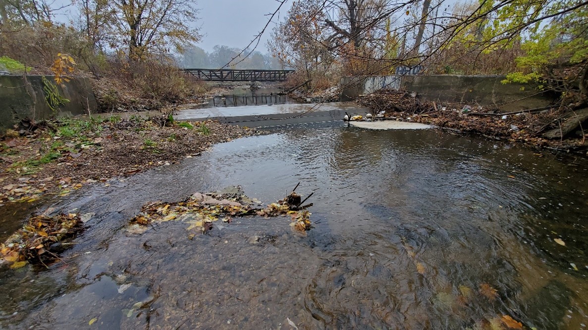
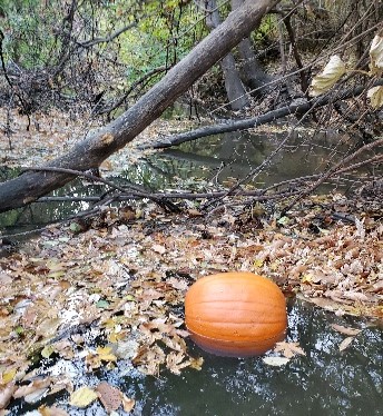
Photo below: An autumn view of Indian Creek near Farnsworth Avenue in Aurora.
Input is welcome from anyone with an interest – a stake – in the quality of the Indian Creek watershed and adjacent Fox River. You don’t have to live, work, or have a business there to be a stakeholder! Perhaps you visit the area to ride your bike on the Fox River Trail or Prairie Path, hike the trails in Fermilab, or paddle on the Fox River. Maybe you’ve shopped at the outlet mall or unique local shops, dined at one of the many restaurants, enjoyed a festival, or went to hear some live music… then you are a stakeholder too!
The input received will help shape water quality-related recommendations that will be incorporated into the Indian Creek Watershed-based Plan. Of the many benefits of developing a watershed-based plan, a key one is that projects and programs identified in such plans become eligible for certain federal grants, including Clean Water Act “Section 319” Nonpoint Source Pollution Control Program grants, and it helps improve ranking for other state and local grants and technical assistance, such as Illinois EPA’s Green Infrastructure Grant Opportunities (GIGO) program.
To provide input and ideas to help inform plan recommendations, visit https://engage.cmap.illinois.gov/.
Photo below: An autumn view of Indian Creek near Farnsworth Avenue in Aurora.
Indian Creek - April 28, 2022 Update
The final sections of the watershed resource inventory (WRI)
are nearing completion. The stream
physical conditions data is being mapped, the stormwater detention basin
assessment field observations are being tabulated, and the pollutant load
estimates for current and future projected land uses are being finalized. An interim final WRI was submitted to
Illinois EPA at the end of March, with the final WRI due by mid-May.
Also in development is the watershed-based action plan which aims to identify potential water quality-based on-the-ground projects, public education and outreach activities, and planning and policy recommendations. Such projects identified in an Illinois EPA-approved watershed-based plan become eligible for federal grant assistance (e.g., Clean Water Act Section 319h Nonpoint Source Pollution Control Program grants). Opportunities for local and state funding and technical assistance (e.g., Illinois EPA’s Green Infrastructure Grant Opportunities program, CMAP’s Local Technical Assistance program) are enhanced as well. Keep an eye on this space and through special announcements for information about participating in the public engagement opportunities and sharing your knowledge and vision for the Indian Creek watershed!
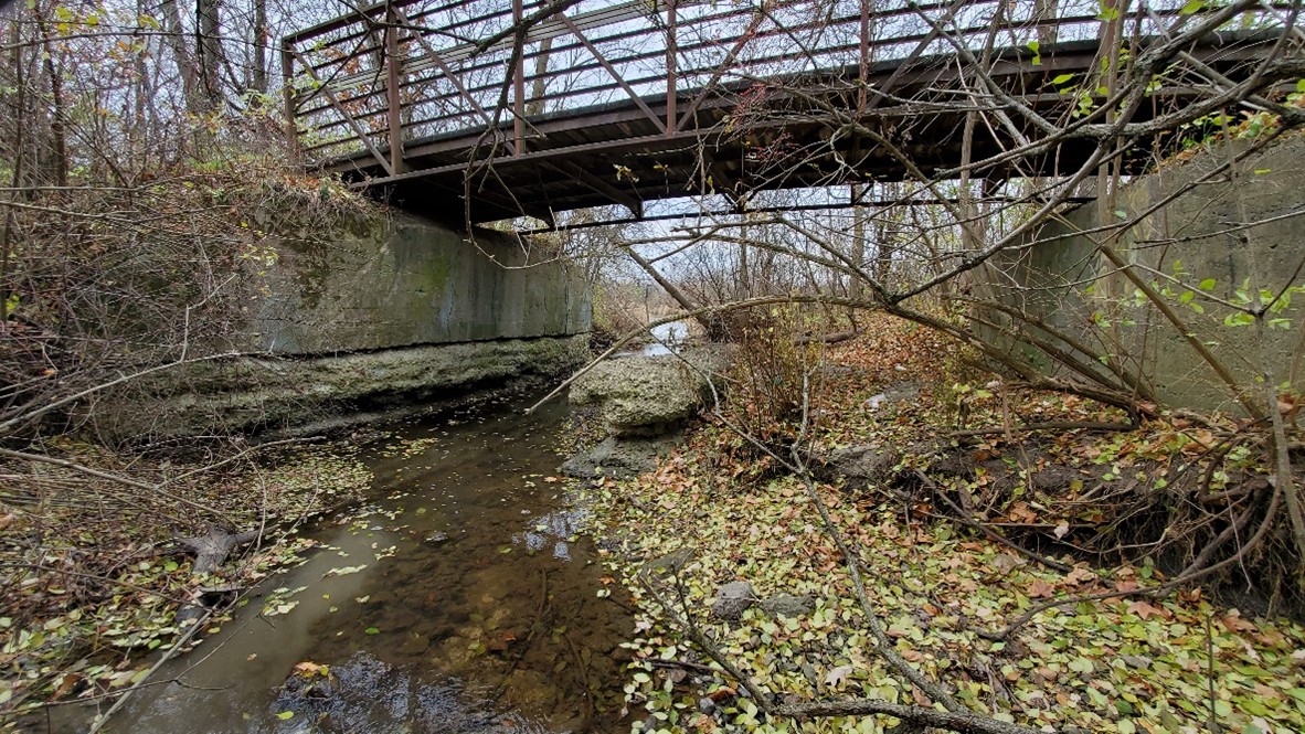
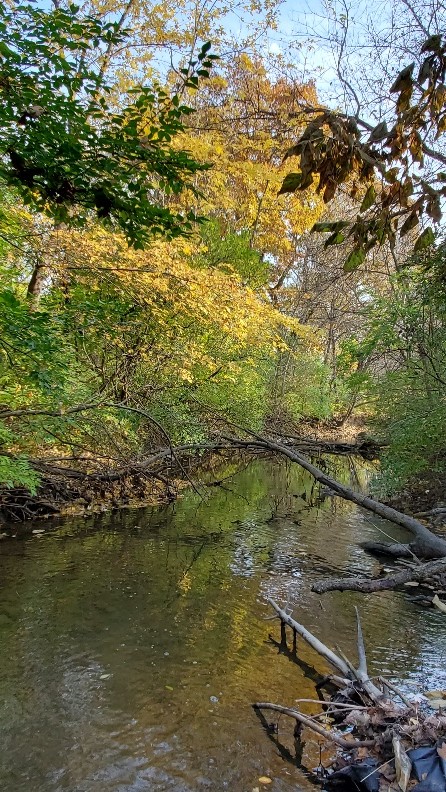
Below photo: A view from Indian Creek looking downstream toward the Fox River Trail bridge in Aurora.
Also in development is the watershed-based action plan which aims to identify potential water quality-based on-the-ground projects, public education and outreach activities, and planning and policy recommendations. Such projects identified in an Illinois EPA-approved watershed-based plan become eligible for federal grant assistance (e.g., Clean Water Act Section 319h Nonpoint Source Pollution Control Program grants). Opportunities for local and state funding and technical assistance (e.g., Illinois EPA’s Green Infrastructure Grant Opportunities program, CMAP’s Local Technical Assistance program) are enhanced as well. Keep an eye on this space and through special announcements for information about participating in the public engagement opportunities and sharing your knowledge and vision for the Indian Creek watershed!
Below photo: A view from Indian Creek looking downstream toward the Fox River Trail bridge in Aurora.
Indian Creek - March 31, 2022 Update
The final pieces of the watershed
resource inventory (WRI) are coming together. CMAP staff have completed
mapping of Poss Lake’s shoreline assessment data and are in the middle
of preparing the various maps and tables that will summarize the stream
physical conditions and stormwater detention basin assessments field
observations. The project’s modeling consultant, Geosyntec, has
completed documentation of the pollutant load estimates from current and
future projected land uses in the planning area and is updating their
report. An interim final WRI will be submitted to Illinois EPA at the
end of March, with a final WRI due by the end of April.
Concurrently underway is the development of the watershed-based action plan which aims to identify potential water quality-based on-the-ground projects, outreach and education activities, and planning and policy recommendations. Included projects thus become eligible for federal grant assistance (e.g., Clean Water Act Section 319h Nonpoint Source Pollution Control Program grants). Opportunities for local and state funding and technical assistance (e.g., Illinois EPA’s Green Infrastructure Grant Opportunities program, CMAP’s Local Technical Assistance program) are enhanced as well. Keep an eye on this space and through special announcements for information about participating in the public engagement opportunities and sharing your knowledge and vision for the watershed!
Below photo: The Batavia Spur of the Illinois Prairie Path crosses over Indian Creek south of Fermilab.
Indian Creek - February 24, 2022 Update
Completion of the final pieces for the watershed resource
inventory (WRI) is in full swing. CMAP
staff are in the middle of preparing the numerous maps and tables that will
summarize the field data collected for stream physical conditions, lake
shoreline conditions, and stormwater detention basin assessments. The modeled pollutant load estimates are
under review by staff and the project’s Advisory Team, and comments are being
compiled for the consultant to address. Staff
also have conducted an updated review of local land use-based plans—including
municipal and county comprehensive, sustainability, and green infrastructure
plans, as well as forest preserve and park district master plans—with an eye
toward how they may incorporate water quality protection policies and/or
practices. The final WRI is due to
Illinois EPA at the end of March.
Concurrently underway is the development of the watershed-based action plan which aims to identify potential water quality-based on-the-ground projects, outreach and education activities, and planning and policy recommendations. Included projects thus become eligible for federal grant assistance (e.g., Clean Water Act Section 319h Nonpoint Source Pollution Control Program grants). Opportunities for local and state funding and technical assistance (e.g., Illinois EPA’s Green Infrastructure Grant Opportunities program, CMAP’s Local Technical Assistance program) are enhanced as well. Keep an eye on this space and through special announcements for information about participating in the public engagement opportunities and sharing your knowledge and vision for the watershed!
Indian Creek - January 26, 2022 Update
Field work to complete the physical conditions assessment of
Indian Creek was completed in mid- January.
CMAP would like to thank Wally Levernier at Fermilab, Rakiya Tasiu with
BNSF Environmental, and Brian Soyk with
BNSF Safety for braving cold weather and icy waters to help get that done. CMAP and Kane County staff continued
assessing detention basins to identify their relative water quality benefit as
well as potential retrofit opportunities via a combination of aerial imagery
and site visits. Hopefully snow holds
off and some relatively warmer days are upcoming (around 30 degrees would be
nice!) to facilitate the assessment of Fox River shoreline erosion conditions
within the planning area. Results of the
field assessments, including maps and tables, will be included in the final
watershed resource inventory targeted for late February.
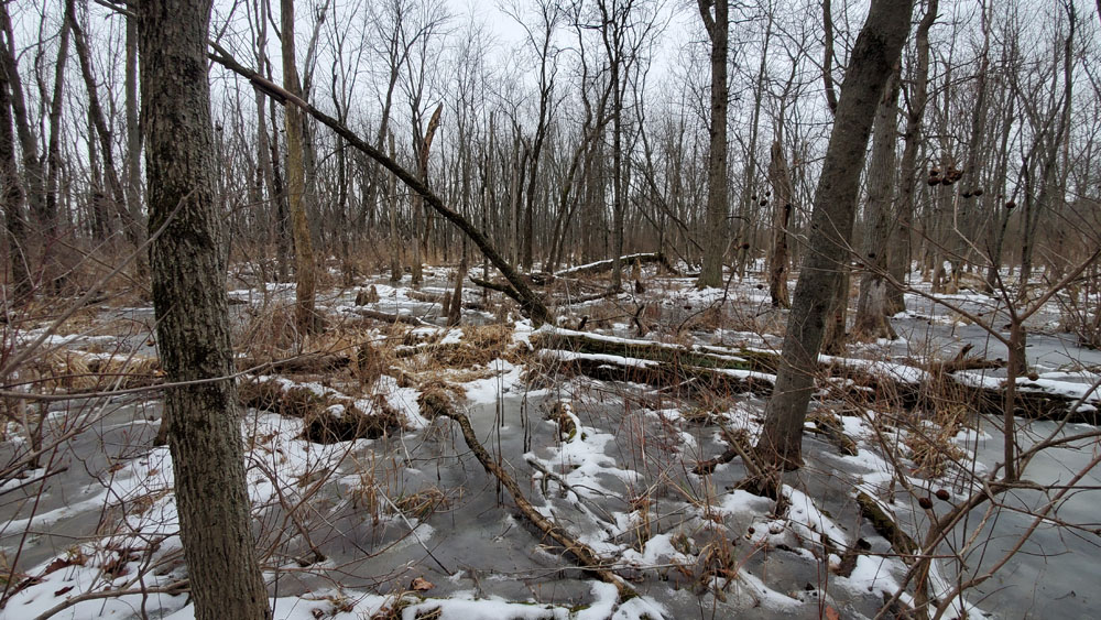
A frozen buttonbush (Cephalanthus occidentalis) swamp was fun to
traverse on the way to a section of Indian Creek within Fermilab in
mid-January.
Next up is the development of the watershed-based action plan. Data gathered during the field assessments
along with input from watershed stakeholders through various public engagement
activities will identify opportunities to protect and improve water and aquatic
habitat quality throughout the 16 square mile Indian Creek planning area. Guided by this input, the plan will identify
potential water quality-based on-the-ground projects, outreach and education
activities, and planning and policy recommendations. These projects then become eligible for
federal grant assistance (e.g., Clean Water Act Section 319h Nonpoint Source
Pollution Control Program grants). Opportunities
for local and state funding and technical assistance are enhanced as well. Continue to keep an eye on this space and
through special announcements for information about participating in the public
engagement opportunities and sharing your knowledge and vision for the
watershed!
Indian Creek - January 3, 2022 Update
The field assessments to round out the watershed resource
inventory (WRI) are almost done. With
hopes for some relatively snow-free days in early January, CMAP staff plans to
assess three remaining Indian Creek sections, evaluate the approximately four miles
of Fox River shoreline within the planning area, and complete the detention
basin inventory and assessment. Results
of the field assessments, including maps and tables, will be included in the
final WRI due to Illinois EPA in mid-February.
Selmarten Creek (above), an Indian Creek tributary, flows westward downstream of Poss Lake through Big Woods Forest Preserve in DuPage County. While invasive Asian clams (Corbicula fluminea, (right) are abundant throughout the Indian Creek watershed stream network (as they are throughout Illinois), it has been positive to find several native Giant Floater (Pyganodon grandis, far right) shells throughout the stream network as well.
In early 2022, the development of the watershed-based action
plan will move into high gear. Data
gathered during the field assessments along with input from watershed
stakeholders through various public engagement activities will identify
opportunities to protect and improve water and aquatic habitat quality
throughout the Indian Creek planning area.
Guided by this input, the plan will outline water quality related
on-the-ground projects, outreach and education activities, and planning and
policy recommendations, which then become eligible for federal grant assistance
as well as other local and state funding and technical assistance
opportunities. Keep an eye on this space
and through special announcements for information about participating in the
public engagement opportunities and sharing your knowledge and vision for the
watershed!
Indian Creek - December 14, 2021 Update
The field assessment portion of the stream physical
conditions inventory is nearing completion.
Thank goodness for some relatively warmer weather days during November
and December! CMAP wishes to thank the
hardy souls who assisted CMAP staff in the assessment of sections of Indian
Creek and its main tributaries during these two months, namely Paul Anderson
with his FREP hat on, Rishab Mahajan and Matt Bardol with Geosyntec, Art Malm
with Friends of the Fox River, Jonathan Hunt and Wally Levernier at Fermilab,
Rob Linke with Kane County Division of Environmental & Water Resources, and
Dan Grigas with the Forest Preserve District of DuPage County. While our fingers and toes may have been a
bit chilly, fall colors and interesting finds helped us not to dwell on the elements.
Staff also have been continuing to assess stormwater
detention basins throughout the watershed planning area. Each of the more than 200 basins are being
visited to confirm basin type (e.g., pond, dry bottom-turf or -mesic prairie,
constructed wetland), native buffer extent, shoreline erosion degree,
maintenance needs, retrofit opportunities, and their relative water quality
benefit. An assessment of nearshore
conditions of the Fox River through the planning area will also be conducted before
year’s end. Results of all the field assessments
will be included in the final watershed resource inventory (WRI) due to
Illinois EPA in mid-February.
Following wrap up of the WRI, the development of the
watershed-based action plan will move into high gear. Engagement activities with watershed
stakeholders will be launched and will help identify opportunities to protect
and improve water and aquatic habitat quality throughout the Indian Creek
planning area. Guided by this input, the
plan will identify water quality related on-the-ground projects, outreach and
education activities, and planning and policy recommendations, which then
become eligible for federal grant assistance as well as other local and state
funding and technical assistance opportunities.
Keep an eye on this space and through special announcements for
information on how you can participate!
Indian Creek - October 26, 2021 Update
The stream physical conditions field assessments began in
September, continued during October, and will be completed in November –
hopefully before the water gets too cold!
CMAP wishes to thank the adventurous individuals who have accompanied
CMAP staff in the wading and assessing of Indian Creek and its main tributaries
so far, namely Jessi DeMartini with the Forest Preserve District of DuPage
County, Rob Linke with Kane County Division of Environmental & Water
Resources, and Patrick Chess and Lauren Swanson with the Forest Preserve
District of Kane County.
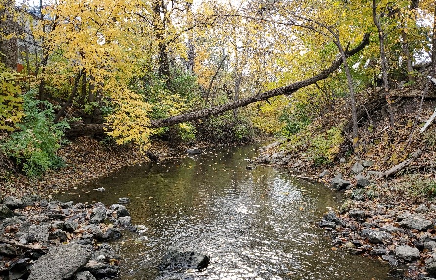
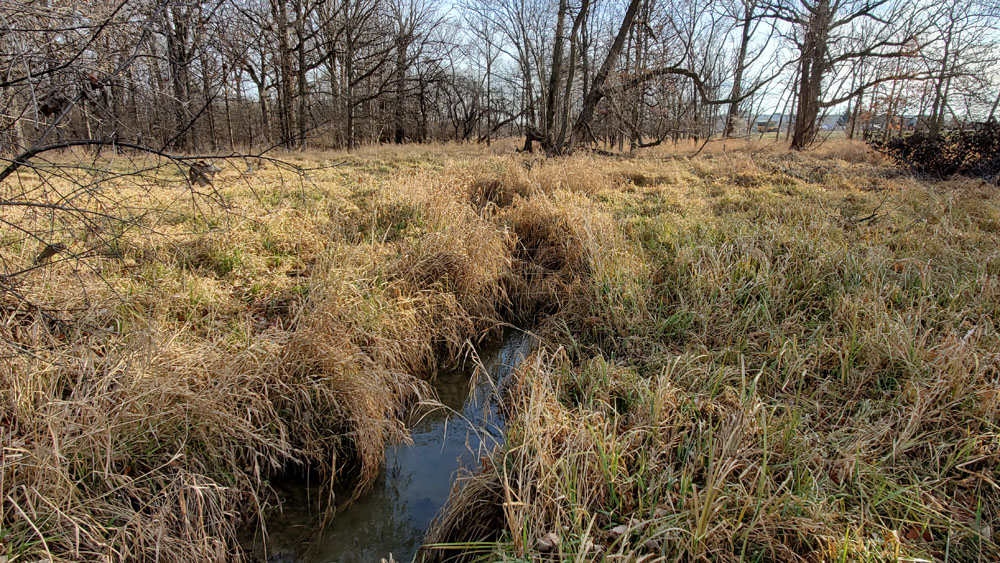
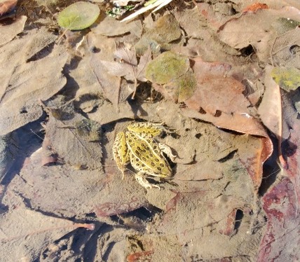
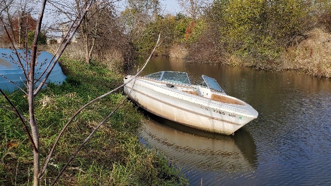
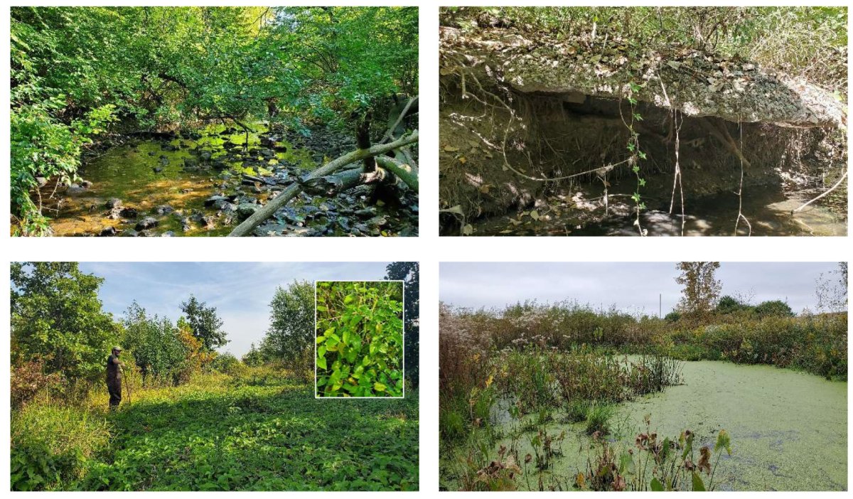
Indian Creek has revealed itself to be a stream of surprisingly variable conditions … from gravelly and cobble strewn stretches under a canopy of trees running through urbanized sections with challenging bank erosion issues (upper photos) … to largely stable, muck-filled reaches winding through sun-filled natural areas overgrown by wetland vegetation or covered by duckweed (lower photos). The sea of lizard’s tail (Saururus cernuus) concealing a section of Indian Creek through the Chicago Premium Outlets Forest Preserve was remarkable!
Indian Creek has revealed itself to be a stream of surprisingly variable conditions … from gravelly and cobble strewn stretches under a canopy of trees running through urbanized sections with challenging bank erosion issues (upper photos) … to largely stable, muck-filled reaches winding through sun-filled natural areas overgrown by wetland vegetation or covered by duckweed (lower photos). The sea of lizard’s tail (Saururus cernuus) concealing a section of Indian Creek through the Chicago Premium Outlets Forest Preserve was remarkable!
Staff also have been continuing to assess stormwater
detention basins throughout the watershed planning area. Each of the more than 200 basins are being
visited to confirm basin type (e.g., pond, dry bottom-turf or -mesic prairie,
constructed wetland), native buffer extent, shoreline erosion degree,
maintenance needs, retrofit opportunities, and their relative water quality
benefit. An assessment of nearshore
conditions of the Fox River through the planning area will also be conducted
before year’s end. Results of all the
field assessments will be included in the final watershed resource inventory
(WRI) due at year’s end.
On the administrative side, Illinois EPA okayed an extension of the grant period through June 30, 2022. Following wrap up of the final WRI by December 31, 2021, the development of the watershed-based plan will move into high gear. Engagement activities with watershed stakeholders will be launched and will help identify opportunities to protect and improve water and aquatic habitat quality throughout the Indian Creek planning area. Keep an eye on this space and through special announcements for information on how you can participate!
On the administrative side, Illinois EPA okayed an extension of the grant period through June 30, 2022. Following wrap up of the final WRI by December 31, 2021, the development of the watershed-based plan will move into high gear. Engagement activities with watershed stakeholders will be launched and will help identify opportunities to protect and improve water and aquatic habitat quality throughout the Indian Creek planning area. Keep an eye on this space and through special announcements for information on how you can participate!
Indian Creek - August 25, 2021 Update
CMAP staff completed the field data collection portion of
the shoreland conditions assessment at Poss Lake in the Big Woods Forest
Preserve. Maps showing shoreline erosion
degree and riparian condition along with a summary of aquatic zone conditions
will be included in the watershed resource inventory (WRI). Additionally at Poss Lake, Illinois EPA staff
have been conducting water sampling this summer, and a summary of their data
will be included in the final WRI as well.
Staff finished development and testing of an ArcGIS Field Maps/Survey 123 combination app to use for recording the stream physical conditions assessment information. Stream assessment field dates are currently being scheduled with partner staff. The field data collection work will continue through the summer and possibly into early fall, dependent on the availability of partner staff to join a CMAP staff person each day when wading Indian Creek and its two main tributaries.
More than 200 stormwater detention basins are present throughout the Indian Creek watershed planning area, and each will be assessed to confirm basin type (e.g., pond, dry bottom-turf or -mesic prairie, constructed wetland), native buffer extent, shoreline erosion degree, maintenance needs, retrofit opportunities, and their relative water quality benefit. Assessments are underway and will continue through the summer/early fall, the results of which will be incorporated into the final WRI.

For the pollutant load modeling requirements of the WRI, a
draft technical report prepared by the project’s consultant, Geosyntec,
describing the HSPF model update process, assumptions, and pollutant load
estimates is under review.
On the administrative side of things, CMAP has asked Illinois EPA for an extension of the grant period through June 30, 2022. Following wrap up of the final WRI by December 31, 2021, the development of the watershed-based plan will move into high gear. Engagement activities with watershed stakeholders will be launched and will help identify opportunities to protect and improve water and aquatic habitat quality throughout the Indian Creek planning area. Keep an eye on this space for information on how you can participate
On the administrative side of things, CMAP has asked Illinois EPA for an extension of the grant period through June 30, 2022. Following wrap up of the final WRI by December 31, 2021, the development of the watershed-based plan will move into high gear. Engagement activities with watershed stakeholders will be launched and will help identify opportunities to protect and improve water and aquatic habitat quality throughout the Indian Creek planning area. Keep an eye on this space for information on how you can participate
Indian Creek - July 6, 2021 Update
CMAP staff finished developing an ArcGIS Field Maps app to
document shoreland conditions at Poss Lake in the Big Woods Forest Preserve as
well as the stretch of the Fox River within the planning area in Aurora. Staff completed approximately two-thirds of
the Poss Lake shoreland assessment over two days in mid-June, documenting
shoreline erosion degree as well as riparian and aquatic zone conditions. One more day at the lake ought to do it, then
a few days along the Fox River. Do wave
if you happen to be paddling by!
Staff also completed development of an ArcGIS Field Maps/Survey 123 combination app to use for recording stream physical conditions assessment information. After doing a test run to ensure all the needed data fields are included and the app is functioning as intended, stream assessment field work is expected to begin during July and continue through the summer, dependent on the availability and scheduling of partner staff to join a CMAP staff person each day when wading Indian Creek.
The project’s modeling consultant, Geosyntec, finalized the HSPF model’s hydrology, completed the model’s water quality calibration for several pollutants (total phosphorus, total nitrogen, suspended solids, fecal coliform, and chloride), and applied the model to simulate pollutant loadings for current land use conditions as well as forecasted, future land use. A draft technical report describing the HSPF model update process, assumptions, and pollutant load estimates is under review.
The shoreland, stream, and detention basin assessment information, along with the pollutant load estimates, will be incorporated into the final watershed resource inventory (WRI) due at the end of the summer. Then development of the watershed-based plan will move to the forefront where engagement activities with watershed stakeholders will help identify opportunities to protect and improve water and aquatic habitat quality throughout the Indian Creek planning area – so stayed tuned on how you can participate!
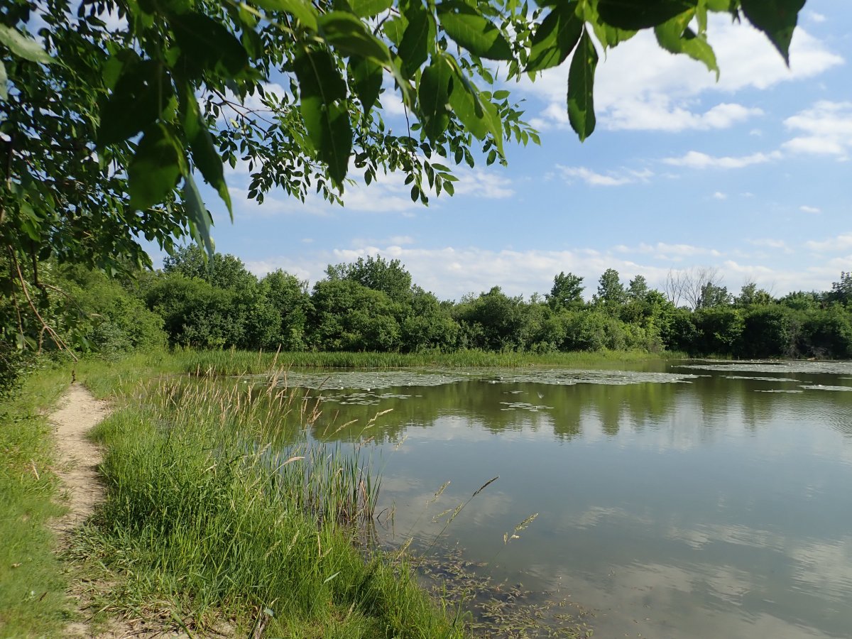
Poss Lake
in the Big Woods Forest Preserve
DuPage County
DuPage County
Indian Creek - April 26, 2021 Update
During April, CMAP staff were able
to get out in the field a couple days to begin the inventory and
assessment of stormwater detention basins, one of the components of the
watershed resources inventory (WRI). Utilizing ESRI ArcGIS Collector
apps previously developed by Kane County Water Resources and DuPage
County Stormwater Management for their respective counties, several
aspects of each detention basin are being confirmed and/or assessed,
including basin type (e.g., pond, dry bottom– turf or mesic prairie,
constructed wetland), side slope cover types, native buffer
presence/extent, shoreline erosion presence/extent, and a general
assessment of the basin’s overall water quality function. Maintenance
needs and potential retrofit opportunities to help improve water quality
are also being noted.
For the stream physical conditions data collection work, staff are finalizing an online map and associated data collection forms utilizing ESRI’s ArcGIS Collector and Survey 123 mobile data collection apps. Similarly, an ArcGIS Collector app is being developed to document lake shoreline conditions for Poss Lake, the only publicly owned, non-detention basin lake in the planning area.
The project’s modeling consultant, Geosyntec, has finished updating the HSPF model’s hydrology and is nearing completion of the water quality calibration for several parameters (total phosphorus, total nitrogen, suspended solids, fecal coliform, and chloride). Once the calibrations are confirmed, the pollutant loads associated with current and future-projected land use in the watershed planning area will be modeled and the results included in the next draft of the WRI.
Indian Creek - March 30, 2021 Update
A second, interim draft of the watershed resource inventory
(WRI) was submitted by CMAP to Illinois EPA at the end of January. This draft addressed comments received from
Illinois EPA and Advisory Team members on the first draft of the WRI and
includes soils maps revisions, identification of additional local plans, and
mapping of potential future land uses based on local municipal and county land
use plans. A third draft of the WRI is
expected to be completed by late April/early May and will incorporate land
use-based pollutant loading estimates for total phosphorus, total nitrogen,
total suspended solids, fecal coliform, and chloride being modeled by Geosyntec
Consultants. The third draft of the WRI will
be posted on the Indian Creek project page on the FREP website, replacing the
first draft currently posted.
After a year of being unable to be out and about the watershed due to staff restrictions associated with COVID-19, CMAP staff are looking forward to beginning field data collection this spring for the stream physical conditions and stormwater detention basin inventory and assessment portions of the WRI. Staff are finalizing an online map and associated data collection forms utilizing ESRI’s ArcGIS Collector and Survey 123 mobile data collection apps to use for the stream data collection work. For the detention basin data, CMAP will utilize the ArcGIS Collector apps previously developed by Kane County and DuPage County to collect information on the stormwater basins in their respective counties. This information will be incorporated into a fourth and final WRI by the end of this summer.
Finally, CMAP staff are developing an online public input platform that will be rolled out in the next couple months. Keep your eyes on this space for that announcement!
Indian Creek - October 29, 2020 Update
Watershed resource inventory development (WRI) continues. CMAP staff are addressing comments received from Illinois EPA on the first draft of the WRI submitted at the end of August. The WRI overviews existing conditions in the Indian Creek watershed planning area including local governments and districts, population and demographics, physical and natural resources, land use and land cover, water quality, pollutant sources, and land and water management practices. The draft is posted on the Indian Creek watershed project page on the FREP website. Sections that have yet to be rounded out include nonpoint source pollutant load estimates as well as stream physical conditions and stormwater detention basin assessments.
CMAP staff are continuing to develop an online map and associated data collection forms utilizing ESRI’s ArcGIS Collector and Survey 123 mobile data collection apps to use for stream conditions field data collection. For the detention basin inventory and assessment, CMAP will utilize the ArcGIS Collector apps previously developed by Kane County and DuPage County to collect information on the stormwater basins in their respective counties. It is hoped that field data collection can start this fall, with the majority to be conducted in the spring. For pollutant load modeling, Geosyntec has updated the Fox River Study Group’s Fox River Watershed HSPF (Hydrological Simulation Program – Fortran) model for the Indian Creek watershed with the latest land use, topography, soils, and storm water drainage data, and has delineated over 200 subwatersheds, or catchments, in the 16 square mile planning area. The HSPF model is continuous simulation model which provides far greater insight into anticipated pollutant loading and load reductions than simplistic models (such as spreadsheet models). The HSPF model will be calibrated to stream gauge flow data collected by Deuchler Engineering for the Fox Metro Water Reclamation District (FMWRD) near the mouth of Indian Creek and by Fermilab in the headwaters of Indian Creek.
The model will then be calibrated for several water quality parameters – total phosphorus, total nitrogen, total suspended solids, fecal coliform, and chloride – utilizing water chemistry data collected in Indian Creek by Illinois EPA and by Deuchler for the FMWRD. In future steps, the model will be used to assess the effectiveness of potential BMPs (best management practices) toward reducing pollutant loads to Indian Creek and the Fox River. The use of this calibrated model for the quantification of pollutant loads and BMP load reduction estimates will enable the stakeholders in the Indian Creek watershed to better allocate resources to achieve target water quality objectives.
Indian Creek - October 1, 2020 Update
A first draft of the watershed resource inventory (WRI) was submitted to Illinois EPA by the Chicago Metropolitan Agency for Planning (CMAP) at the end of August. The WRI overviews existing conditions in the Indian Creek watershed planning area including local governments and districts, population and demographics, physical and natural resources, land use and land cover, water quality, pollutant sources, and land and water management practices. The draft is posted on the Indian Creek watershed project page on the FREP website. Some sections that have yet to be rounded out include nonpoint source pollutant load estimates as well as stream physical conditions and stormwater detention basin assessments. For pollutant load modeling, Geosyntec is in the process of updating the Fox River Study Group’s Fox River Watershed HSPF (Hydrological Simulation Program – Fortran) model to apply it to the Indian Creek watershed. They have updated the model with the latest land use, topography, soils, and storm water drainage data; and have delineated over 200 subwatersheds, or catchments, in the 16 square mile planning area. Smaller drainage catchments allow for improved representation of hydrology and pollutant loads and, in future steps, assessing effectiveness of potential BMPs (best management practices) in reducing pollutant loads to Indian Creek and the Fox River.
To facilitate stream conditions field data collection, CMAP is creating an online map and associated data collection forms utilizing ESRI’s ArcGIS Collector and Survey 123 mobile data collection apps. For the detention basin inventory and assessment, CMAP will utilize the ArcGIS Collector apps previously developed by Kane County and DuPage County to collect information on the stormwater basins in their respective counties. Field data collection is expected to begin in October and continue into next spring. Public engagement activities will be planned for the winter months to gain additional insights into watershed conditions and learn about opportunities for water quality improvement and habitat protection and restoration.
To facilitate stream conditions field data collection, CMAP is creating an online map and associated data collection forms utilizing ESRI’s ArcGIS Collector and Survey 123 mobile data collection apps. For the detention basin inventory and assessment, CMAP will utilize the ArcGIS Collector apps previously developed by Kane County and DuPage County to collect information on the stormwater basins in their respective counties. Field data collection is expected to begin in October and continue into next spring. Public engagement activities will be planned for the winter months to gain additional insights into watershed conditions and learn about opportunities for water quality improvement and habitat protection and restoration.
Indian Creek - August 2020 Update
Preparation of the watershed resource inventory (WRI) is ongoing. CMAP is documenting existing conditions in the watershed including local governments and districts, population and demographics, physical and natural resources, land use and land cover, water quality, pollutant sources, and land and water management practices. To provide the pollutant load modeling requirement of the WRI, thanks to support from the Fox River Study Group (FRSG), CMAP subcontracted with Geosyntec to update and apply the FRSG’s Fox River Watershed HSPF (Hydrological Simulation Program – Fortran) model to the Indian Creek watershed. Geosyntec is currently updating the model with the latest land use, topography, soils, and storm water drainage data for the planning area. A draft WRI is due to Illinois EPA at the end of August, with a final WRI due at the end of November.
Public engagement activities will be planned following the completion of the draft WRI to gain additional insights into watershed conditions and learn about opportunities for water quality and habitat protection and restoration in the watershed.
Indian Creek - July 2020 Update
The project webpage has been set up on the FREP website, posting project news, documents, maps, photos, and meeting materials. Project updates also will be provided monthly through FREP’s Downstream e-newsletter and will be subsequently posted on the webpage.
CMAP finalized the planning area in mid-April following the concurrence of the project’s Advisory Team and Illinois EPA to add approximately 1.7 square miles of direct drainage area to the Fox River that adjoins the 14.4 square mile Indian Creek watershed, to form a 16.1 square mile Indian Creek watershed planning area. Preparation of the watershed resource inventory (WRI) is underway to document watershed conditions including local governments and districts, population and demographics, physical and natural resources, land use and land cover, water resource conditions, pollutant sources, and land and water management practices. A draft WRI is due to Illinois EPA at the end of August.
The project’s Advisory Team met in early April via video conference. CMAP staff presented an overview of the project including purpose, requirements, and timeline; sought input on the proposed watershed planning area boundary, GIS datasets, and public input and engagement; and asked AT members to complete a visioning exercise. AT members as well as other state and local planning partners have continued to support WRI development by providing GIS datasets, water quality data, and pollutant modeling resources.