Ferson-Otter Creek Watershed

Ferson-Otter Creek Watershed
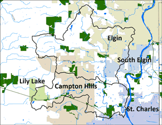
The Ferson-Otter Creek watershed consists of two subwatersheds: Ferson Creek and Otter Creek. However for our planning purposes, the two subwatersheds will be studied together as Ferson Creek is a major tributary to Otter Creek. The Ferson-Otter Creek watershed has a drainage area of approximately 54 square miles, with 29% of the land area developed. The watershed is located on the urban fringe of the Chicago Metropolitan area in Kane County, the 5th fastest growing county in Illinois and covers portions of the Cities of Elgin and St. Charles as well as the Villages of Campton Hills, South Elgin, and Lily Lake. The total population in Ferson-Otter Creek watershed is approximately 32,515.
The Ferson-Otter Creek Watershed Plan was adopted in December 2011. The project was made possible by Section 604(b) of the Clean Water Act, as amended, and the Illinois Environmental Protection Agency, Bureau of Water, who distributed funds to the Chicago Metropolitan Agency for Planning (CMAP). CMAP, the regional planning agency for the seven counties of northeastern Illinois and the delegated authority for the region’s areawide water quality management plan, led the planning process.
This plan was prepared for the Ferson –Otter Creek Watershed Coalition that formed as the plan neared completion. The many contributors to this planning process include Trotter and Associates, Campton Township, Village of South Elgin, Village of Campton Hills, Village of Lily Lake, City of Elgin, City of St. Charles, Kane County Planning, Kane-DuPage Soil and Water Conservation District, Natural Resources Conservation Service, Kane County Health Department, Pizzo and Associates, St. Charles Park District, Lake Campton Property Owners Association, Wildrose Subdivision, The Windings of Ferson Creek HOA, Deer Run Creek HOA, Deer Run East Property Owners Association, Black Creek Hydrology, and the Sierra Club.
Ferson Creek Dam Removal
This project represented Phase I of multi-phased program to create uninterrupted fish passage throughout 44 miles of stream habitat in the Ferson-Creek watershed. The primary objective for Phase I was to remove the impassable dam at Creek Bend Forest Preserve and to modify one low-water barrier located downstream of Creek Bend, in order to open 6.3 miles of lower Ferson-Otter Creek to the Fox River,
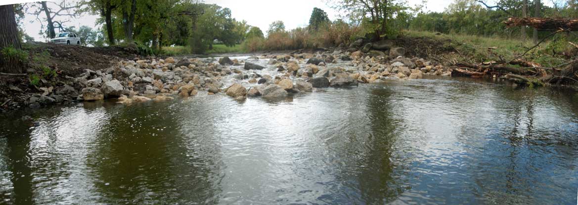
Shown right, Ferson Creek dam before, and after removal.
This project represented Phase I of multi-phased program to create uninterrupted fish passage throughout 44 miles of stream habitat in the Ferson-Creek watershed. The primary objective for Phase I was to remove the impassable dam at Creek Bend Forest Preserve and to modify one low-water barrier located downstream of Creek Bend, in order to open 6.3 miles of lower Ferson-Otter Creek to the Fox River,
The project was completed in 2010.
Shown right, Ferson Creek dam before, and after removal.

